Great news! The National Geographic Society is going to fund a short field season studying the foraging ecology of fin whales in the Long Eddy, an island wake system in the Bay of Fundy. This is a great opportunity for us to get back to Fundy.
This island wake system supports a variety of top predators (whales, porpoises and seabirds) and is highly predictable in time and space, making it – in many ways – an ideal natural laboratory for studying the foraging ecology of marine mammals. We hope to study how fin whales exploit this features during foraging using digital recording tags (drags) and a suitep of “ecosystem” observations made concurrently to provide the environmental context for observed behaviors. This will include measures of prey fields observed with active acoustics, ocean currents obtained by ADCP, and water properties assessed through CTD casts.
Island or headland wake systems are ubiquitous in coastal oceans, found pretty much wherever water flows past an obstruction. Because these systems are so common, understanding how marine predators such as fin whales use the Long Eddy can help us interpret patterns in their distribution and movements in other coastal regions. One of my key interests in this project is a deeper assessment of the utility of using studies that combine fine-scale oceanography with the movements and behaviors of top predators to delineate the extents of marine protected areas.
It also means that we will get the opportunity to further develop our nascent photo ID catalog of fin whales around Grand Manan Island. It should be interesting to see if the same whales we studied there almost a decade ago still use the feature as a foraging spot.
Can’t wait to get started!
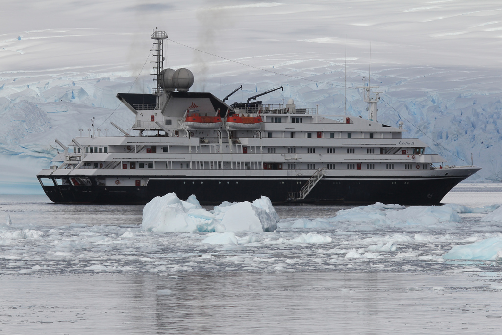
This is video of the Clelia II on her way back from the WAP. She was about 800 miles from Ushuaia. She took a large wave over bridge which blew in a window and doused some electronics. No major damage, but it slowed the ship down a bit. Two trips south between that one and ours. Hope we don’t get this weather!
[dropcap4 color="green"]O[/dropcap4]ver the past 26 hours my 8-core monster Mac Pro has been crunching numbers like never before. I’ve had it running a public domain climate modeling software package called EdGCM. This package, created by scientists at Columbia University, is based on a research-grade global circulation model produced by NASA called GISS II and has been developed primarily for educational uses in colleges, universities and even high schools. You can download a copy of the software for yourself here.
[image align="right" lightbox="false" link="http://edgcm.columbia.edu/"]http://superpod.ml.duke.edu/johnston/files/2010/12/20101201-052312.jpg[/image]My first simulation – extending 100 or so years into the future – was based on a very simple warming scenario included in the package as a demonstration. The model provides an amazing amount of output, and I’m just getting into some of the maps. The next step is to run it using parameters from the IPCC models currently under consideration.
The best thing about this package is that we can use it for an upcoming class on climate change and marine mammals that Ari Friedlaender and I are teaching this spring at the lab. We now have a tool that allows us to compare current conditions in marine mammal habitats (surface air temperatures at pinniped haul outs, ice conditions in both polar regions, sea surface temperatures etc…) around the world with what may occur if global warming occurs according to a range of predictions, and that provides for a lot of material for projects in the class!
[image title="SST after 100yrs - EDGCM IPCC A1" size="large" align="center" icon="zoom" lightbox="true" autoHeight="true"]http://superpod.ml.duke.edu/johnston/files/2010/12/IPCC_A1_GISSII_WINTER_2100.png[/image]